August 24 - 26, 2012 |
|
|||||
 |
||||||
Newport Bucket: 2011 Race Courses |
||||||
|
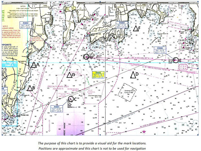
2011 NEWPORT BUCKET REGATTA
POTENTIAL MARKS FOR THE VARIOUS COURSES (pdf) Mark location descriptions below are approximate. Values are expressed in degrees, minutes and decimals of minutes.
Sailing Instructions - Exhibit 2 COURSES - willl be posted |
||||||